AVHRR METOP-A
The Advanced Very High Resolution Radiometer (AVHRR) is a cross-track scanning system with five spectral bands having a resolution of 1.1 km and a frequency of earth scans twice per day (0230 and 1430 local solar time). There are three data types produced from the POES AVHRR. The Global Area Coverage (GAC) data set is reduced resolution image data that is processed onboard the satellite taking only one line out of every three and averaging every four of five adjacent samples along the scan line; the Local Area Coverage (LAC) data set is recorded onboard at original resolution (1.1 km) for part of an orbit and later transmitted to earth; and the High Resolution Picture Transmission (HRPT) is real-time downlink data. A fourth data type, Full Resolution Area Coverage (FRAC 1.1 km) is now available daily for the entire globe with the launch of MetOp-A, on October 19, 2006, Europe's first polar orbiting operational meteorological satellite system and the first of the European contribution to the Initial Joint Polar-Orbiting Operational Satellite System (IJPS). https://www.avl.class.noaa.gov/release/data_available/avhrr/index.htm
JEDI HofX
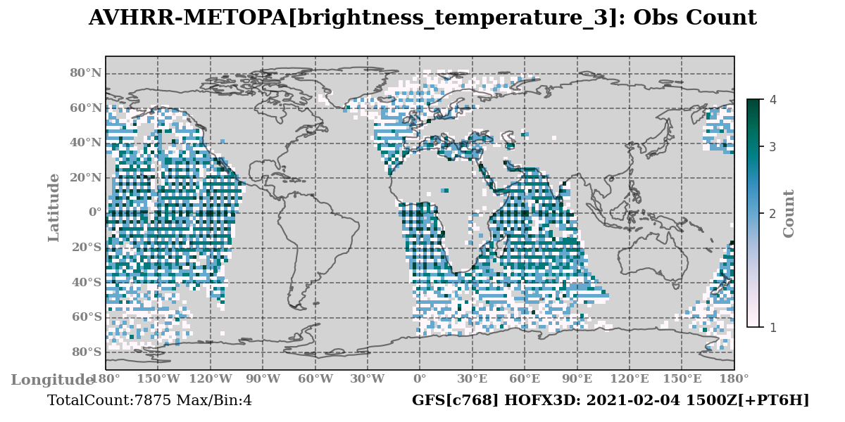
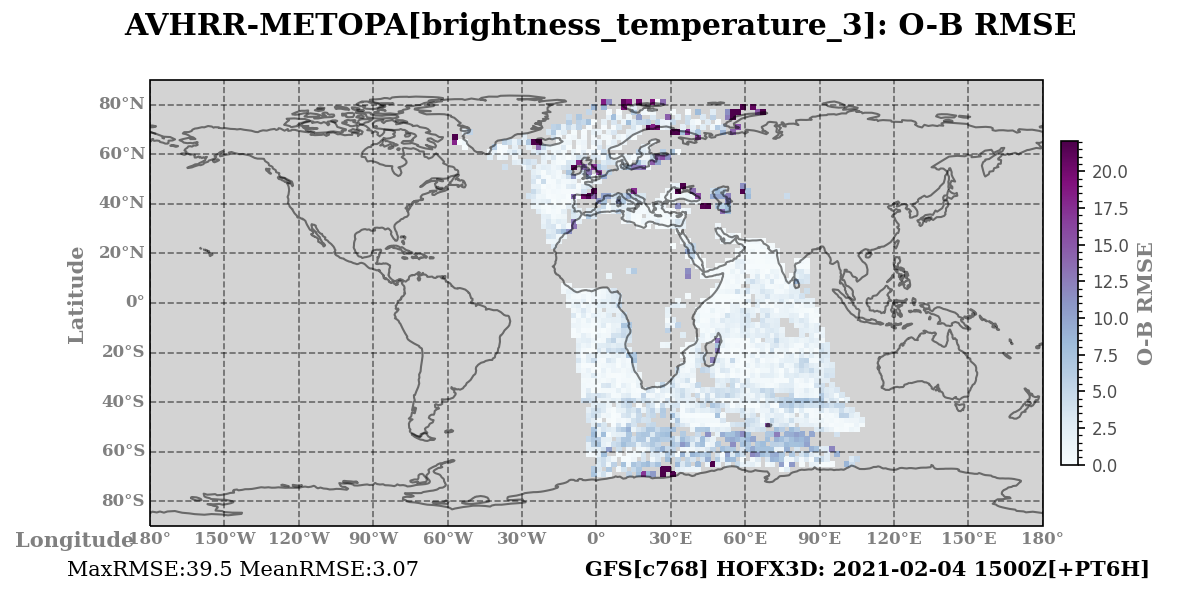
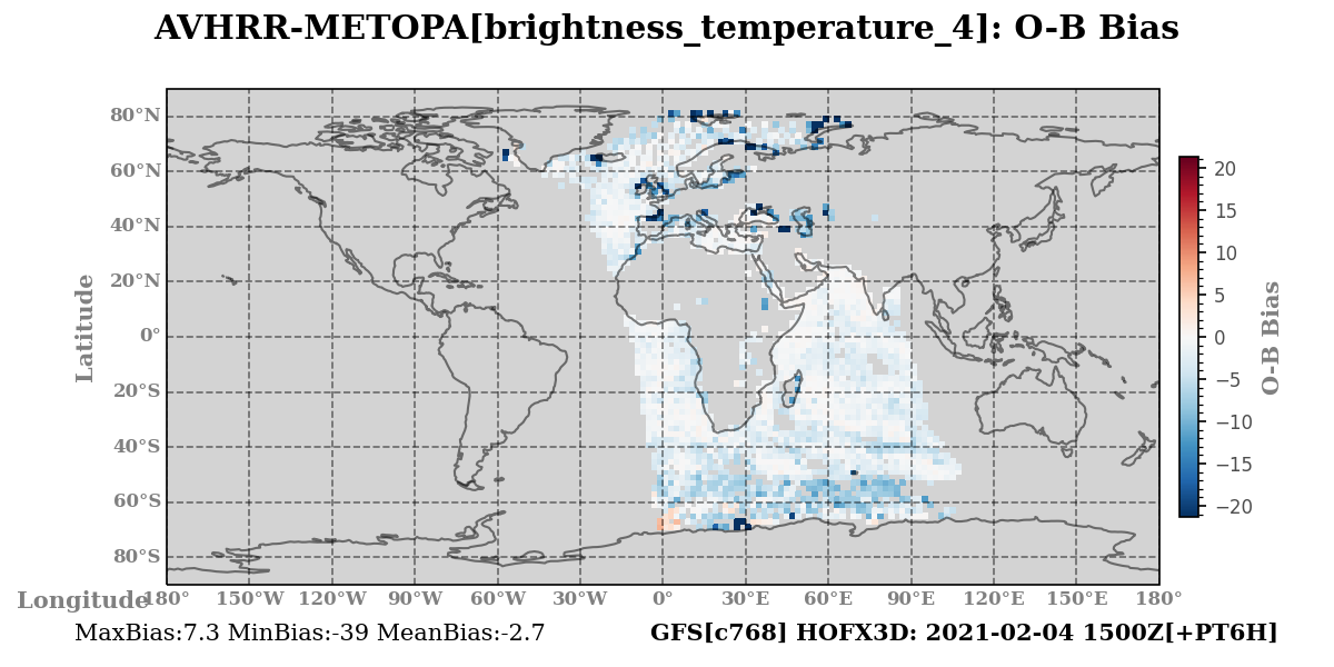
For each variable and/or satellite channel, shown are the observation counts (left), O-B RMSD (center), and O-B bias (right).
Click on any variable name below to expand and view the plots.
brightness_temperature_3

brightness_temperature_4


brightness_temperature_5


